What tease! This great map begs for my close scrutiny. Alas! It will not bear it.
Edit: Here is a decent hi res map of the watershed. Boy, do I want to read every detail of that map you shared, OP. I’m going down the rabbit-hole!
Edit2: Another mid/low res map of the basin, but its awfully MS-Paint.
Edit3: found this digital version, but no better, really:
EditFinal: Here’s a depth and elevation profile that I found that’s clear and fairly detailed. I am too busy today to get further sucked in, but I could spend the rest of my day staring at these maps…


What tease! This great map begs for my close scrutiny. Alas! It will not bear it.
Edit: Here is a decent hi res map of the watershed. Boy, do I want to read every detail of that map you shared, OP. I’m going down the rabbit-hole!
Edit2: Another mid/low res map of the basin, but its awfully MS-Paint.
Edit3: found this digital version, but no better, really: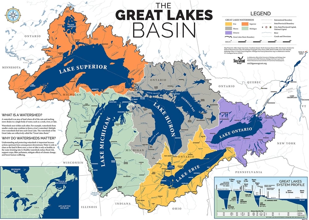
EditFinal: Here’s a depth and elevation profile that I found that’s clear and fairly detailed. I am too busy today to get further sucked in, but I could spend the rest of my day staring at these maps…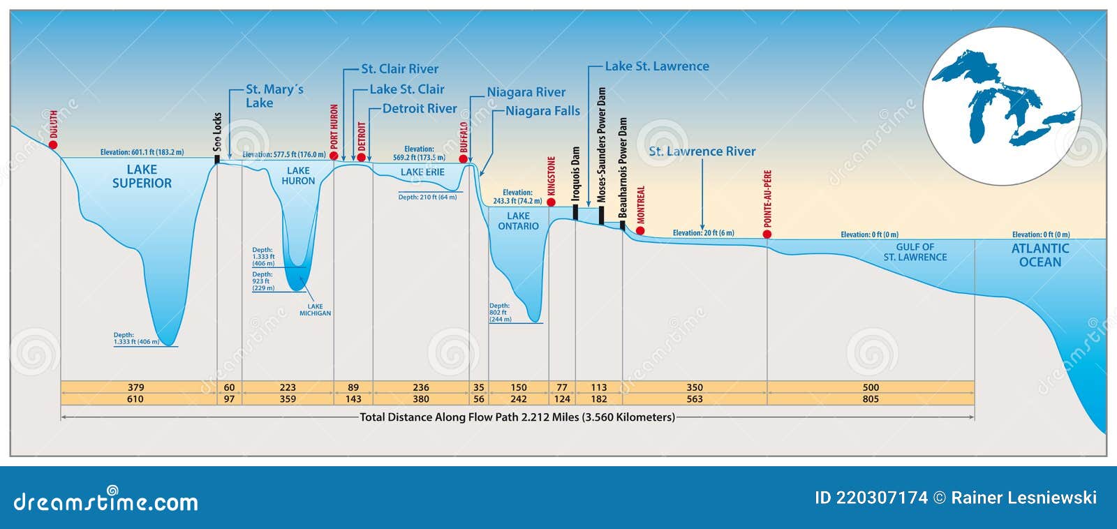
These damn Canadians will not get away with their Lake Michigan erasure!!!
Caaaan ya find one similar for the Chesapeake Bay?